Came across this blog today. It takes us back to Mull and makes us look forward to Skye.
http://www.mullseaeagles.blogspot.com
Saturday 22 August 2009
Sunday 9 August 2009
Christchurch - Bonus Island

The big tree on the right is actually a small island in the Avon that you can see from the northernmost bridge of the post below. It doesn't appear to hold much more than a group of trees in a very pretty location.
Labels:
Christchurch,
DC,
south coast
Christchurch Pt 4

Following the Avon Valley Path north past the private fishing grounds and under the rail bridge we come to the end of Mill Road where this bridge crosses to an island in the Avon.

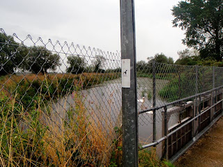
Water rushes beneath the bridge that also supports an industrial building.

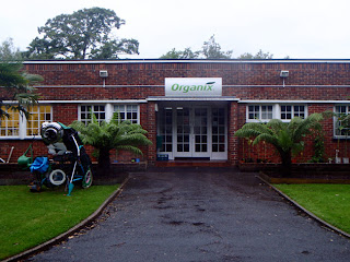
On the island is a commercial building occupied by Organix and a private home on the southern tip.

A second bridge takes us north off the island to a second unibhabited one.

It looks artificially shaped for some purpose, and does seem to be used for fishing.

The third bridge takes us from one part of the island to another.

This final bridge, the furthest north, takes us off of the island and onto a large green field.
Labels:
Christchurch,
DC,
south coast
Saturday 8 August 2009
Christchurch Pt 3 - The Ducking Stool and A35
Walking back on the 'mainland' side, we follow a road back to Mill Stream and it's infamous ducking stool. The north part of the island is across the stream.


Following the stream north we meet the Christchurch bypass, the very noisy A35.

Crossing the west bridge on the bypass, over Mill Stream. The north part of the island stretches out ahead.

Grassy pasture, shallow running water, perfect for fishing.

From the east bridge looking northwest.

On the north part of the island.

The bridge off the island.


Following the stream north we meet the Christchurch bypass, the very noisy A35.

Crossing the west bridge on the bypass, over Mill Stream. The north part of the island stretches out ahead.

Grassy pasture, shallow running water, perfect for fishing.

From the east bridge looking northwest.

On the north part of the island.

The bridge off the island.
Labels:
Christchurch,
DC,
south coast
Friday 7 August 2009
Christchurch Pt 2 - The Norman House to Place Mill
 The Norman House
From the medieval bridge, a thin strip of land flanked by The Avon and Mill Stream (pictured), runs south past The Norman House ruins. This is the thinnest part of a long island that can be divided into two parts. South from Bridge Street has a tarmac promenade that leads to housing and a boatyard. North is the larger, green area of fields and fishing bisected by the noisy A35 which we'll cover in the next post.
Continuing south we pass the magnificent Christchurch Priory which in Simon Jenkins' book Thousand Best Churches was one of only eighteen churches to be awarded 5 stars.

Eventually we emerge from the tree lined path to a clump of new housing. To the east is a kind of gated community of small (holiday?) homes and boat yard.

Next to it is an angular, nautical housing estate that's been crammed in here.

Where the back yard is a large pool for the home owners boats.

This is the view from the southern tip.

As we circle round the estate, we naturally emerge onto this old bridge, taking us off the island.

And to Place Mill that was mentioned in the Domesday Book which now houses some kitsch art exhibitions.
Labels:
Christchurch,
DC,
south coast
Thursday 6 August 2009
Christchurch - Pt 1
We went to Christchurch today to find some inland islands. They don't seem to have any official names. Addresses on the island in this post settle for Bridge Street, Christchurch or Rossiter's Quay, Christchurch. A beautiful medieval bridge carries the visitor onto the island, along with the traffic.
If an island is something as simple as a land mass surrounded by water then these islands certainly fit the bill.
 Bridge Street
Bridge Street runs straight across the island and is lined with fine historical buildings and quite a few empty shops.
Rossiter's Quay is a new development, think Venice in the Little England style.
Once through the houses you get to a great boatyard. Boats scatter the ground and bristle the bank like iron filings on a magnet.
Labels:
Christchurch,
DC,
south coast
Wednesday 5 August 2009
Outdoor Photography Island Journal Pt 2

T's latest installment of the island journal has just been published in Outdoor Photography, issue 117, September 2009. The piece concentrates on Coll & Tiree.
Labels:
articles,
Coll,
Island Journal,
Outdoor Photography magazine,
TH,
Tiree
Tuesday 4 August 2009
Stack Rock
 |
| Stack Rock |
Just before the industrial jetties of Milford Haven sits Stack Rock. On the rock sits a fort built in the 1860s. It has a very pleasing rounded shape with a roof used by wild animals as a playground. Though dilapidated, it's still an impressive structure, and comes as no surprise that it was bought on the open market a few years ago.
Labels:
DC,
Pembrokeshire
Monday 3 August 2009
Three island walk
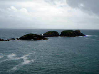
Walking from St Non's to Whitesands on 14/07/09, we passed three small islet clusters. Carreg Fran was first, stretching an arm out to the mainland. It's also known as Crow Island.
 |
| Carreg yr Esgob |
Carreg yr Esgob has an unusual hole shaped like an upright letter box. You can just see it in the middle rock.
Labels:
DC,
Pembrokeshire
Sunday 2 August 2009
Saturday 1 August 2009
Subscribe to:
Posts (Atom)


